MORN. / MORNING
Big Almaty Peak: the long climb and the Cosmostation ridge
The long climb from Alma-Arasan and the shorter Cosmostation ridge: how the published routes differ, with access and the return journey in the plan.
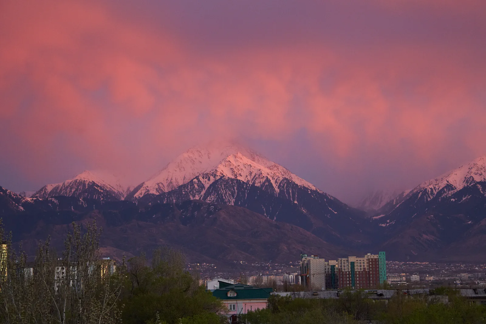
At 3,680 metres, Big Almaty Peak calls for a separate mountain day. First choose how you will approach it: the long forest-and-glade climb from Alma-Arasan, or the shorter ridge approach from the Cosmostation, which depends on an agreed mountain transfer and permitted access. The summit is marked on Google Maps and 2GIS. These pins identify the mountain, not a complete hiking route. Plan the approach, summit route and return before setting out.
Do you need a guide?
Planning independently does not mean hiking alone. Kazakhstan’s emergency ministry recommends using trusted guides and not going into the mountains alone. A group planning its own outing needs experience in navigation, assessing conditions and descending loose and rocky terrain. Fitness and a map pin are not enough; this article does not replace route preparation.
If that experience is missing, discuss a suitable outing with a trusted guide or choose an easier route. Hiring a guide does not guarantee access or reaching the summit. If conditions are unsuitable or the route is closed, change or postpone the outing, even if you have already arranged a guide. Below are two published MORN formats.
When choosing a guide from reviews, check which outing each review describes. A review of another tour with the same organiser does not establish that the Big Almaty Peak route you are considering was completed. Neither does a booking or payment. This applies to MORN offers too.
The long day starts in Alma-Arasan
The classic guided hike starts by Alma-Arasan sanatorium, climbs through spruce forest to Terra glade (Google Maps, 2GIS) and continues towards the summit. Its published itinerary is 20 km with about 2,000 metres of ascent, from 07:00 to 19:00. Those figures describe that guided format, rated intermediate to advanced, rather than every possible route up the mountain.
Arrange the meeting point before organising your ride from Almaty. The classic programme does not include the city transfer, so reaching the trailhead comes before its twelve-hour mountain itinerary. The Alma-Arasan bus stop is a useful named reference for the approach, not a substitute for the organiser’s meeting instructions. City buses use ONAY. Settle how you will get back to the city as well.
The ridge from the Cosmostation
The Cosmostation programme starts with a mountain transfer from Edelweiss to the research station. Before choosing it, ask the organiser to confirm permitted access and both transfer legs for your date. Visitors’ private cars, motorcycles, e-scooters and e-bikes are prohibited on the restricted lake road under the 30 April 2026 notice. If the transfer cannot be confirmed, choose another outing rather than improvise a walk up that road.
From the Cosmostation (2GIS), you walk along the ridge towards the summit and return the same way. The published programme lists 2.5 km uphill, 5 km total and about 400 metres of ascent, within a 5–6-hour outing. These are the programme’s figures, not a promise of your walking time. Arrange the meeting place at Edelweiss (2GIS) with the organiser; these pins mark the lodge, not the checkpoint.
What the ground underfoot looks like
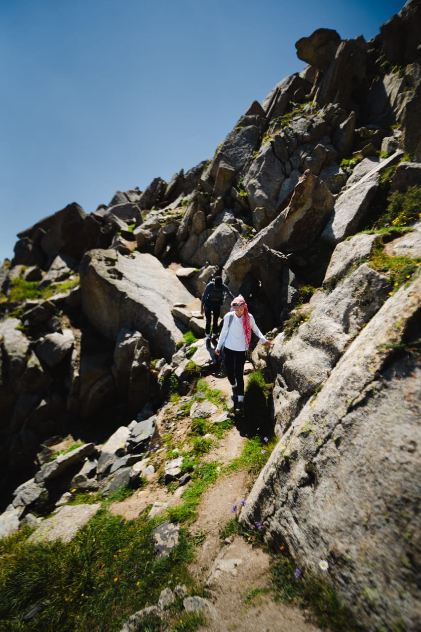
A short distance does not remove the loose ground and rock steps. Plan for the descent over that terrain as well as the climb. Demal’s route description distinguishes the south summit from a further traverse to the north summit. Establish which summit your plan includes; the extra traverse is not an automatic part of every ascent.
Before setting out
Carry your original passport and clarify your specific summit route with the national park or border authorities. Permission to visit the lake does not settle access higher up. Allow for the park’s pedestrian entry charge. If you choose a lake visit instead, use the Big Almaty Lake guide to plan that separate walk.
Both product pages list May–February as their season. That doesn't mean every winter date is suitable or accessible. Before setting out, open Kazhydromet’s storm warnings. Start with today’s date and check both “Алматинская область” (Almaty Region) and “Алматы” (Almaty). Wait for the results to load and match the named mountain areas, dates and hours of validity to your outing and return; do not rely only on filtering for a future date. A warning covering the city’s mountain districts may appear under the region.
Kazhydromet’s regional forecast on the “БАО” page helps check the wider weather picture. Check the location and dates: regional or lake forecasts do not describe conditions on the summit and ridge. For any point forecast, also check the place name, stated elevation and day of your outing.
Empty results, old dates or a loading error do not mean there is no danger. Until you have the relevant information, the weather check is incomplete. A warning of dangerous conditions on your route or a closure is a reason to change the plan; a favourable forecast does not override it.
One plan for the group
Once you have chosen a date and approach, divide the preparation: some participants can check the route and transport while others check weather and restrictions for the same outing. Bring the results together in one note before starting. Use a separate record for another group or date.
- Build the plan. Include the date and participants, walking start, chosen summit and return route, turnaround and expected return times, meeting points and transport in both directions. Add the access and weather findings, source links and time checked. Each participant should have an accessible copy; do not mark unknown information as checked.
- Agree who sends it. Choose a participant to notify rescuers and close the registration after returning, plus someone who agrees to take over those tasks if needed. The emergency ministry’s rules provide for one participant to notify on behalf of a group with everyone’s details. Register with Almaty Hike using the official instructions; if the service is unavailable, use another notification method listed in the ministry’s rules. Do not assume one form has automatically covered everyone. If you have a guide, establish which of these tasks they will handle.
- Check that it was received. Before leaving, give the current plan to the participants and a trusted person staying in the city, and check that they have received it. Saving a note sends nothing. If the handover has not happened or nobody can do it, the step remains incomplete: agree who will take over rather than assuming it is done.
- Revisit affected steps when plans change. If the date, group, approach or summit changes before departure, recheck the affected access, weather period, meetings, transport and return arrangements. Update the record and pass it to its recipients; ask the official channel how to amend an already submitted notification.
After returning, the chosen participant or agreed replacement tells the trusted contact the group is back and closes the registration that was created. If you use another notification method, ask that official channel before departure how to report your return, and do so after the hike.
This is a way to pass on agreed plans, not permission to use the route. An incomplete check remains incomplete; each participant can decide not to go.
Leave enough day for the way down
Agree a turnaround time and the return transport before starting. On the classic route, the published 07:00–19:00 programme needs particular care in autumn’s shorter daylight. Carry a head torch, but plan the descent in daylight rather than using the lamp to extend the climb. Follow MORN’s guide advice to return by your outward route; an unfamiliar descent into another gorge changes the outing when you are already tired.
Return to the approach you are considering: Alma-Arasan or Cosmostation.
Programme and access information: 3 November 2026.